
Aquatic Park’s human-made lagoons are an almost accidental by-product of building the Bay Bridge, the Bay Area’s largest public works project of the Great Depression. California had authorized a bridge and a joint federal-state commission had begun evaluating designs just before the 1929 crash, but then things moved fast. Bridge builders spanned the Bay at what now seems near-lightning speed between 1933 and 1936. To avoid massive traffic jams, the project included a straight feeder road funnelling traffic from cities to the north — Eastshore Highway. Close to the bridge in South Berkeley and Emeryville, this first version of today’s I-80 was built on fill just offshore. The shoreline had been turned over to the transcontinental railroad tracks in the 1870s.
The new highway cut off a long finger of tide flat and shallow bay that would have become a cesspool. Emeryville, incorporated for industry, within a few years filled its lagoon, the one on the right in the photo above.

A Depression-era pivot: Since 1900, Berkeley’s waterfront planning had focused on expanding industry, filling the Bay, and creating a deep-water port and later, airport. Vague talk of a water park started in 1925, as garbage fill wiped out North Berkeley’s mile-long sandy beach. But the city manager’s 1932 annual report, left, showcased a plan for a huge seawall spanning the waterfront and industrial fill and wharves from the planned Bay Bridge near Treasure Island to Richmond.

As the Depression bit deeper and the bridge construction began, Berkeley pivoted, applying for a $1 million federal grant to create a park and yacht harbor. Most of the money would go to create hundreds of jobs through the Works Progress Administration. The longtime harbormaster said later that it was a longshot, not expected to succeed. Final approval, announced by telegram in October 1935, with work to start at once, was greeted joyfully, the Berkeley Gazette story at left announced. The city even brushed off a business-interest request to add a deep-water channel to keep options open.
The city had never before encouraged its citizens to enjoy the waterfront. Aquatic Park began a transformation in waterfront use that continues today.


The Berkeley Recreation Department’s 1935-6 Annual Report shows there was little time to plan. Above, Top left: The cover drawing, by James Plachek, architect of many Depression-era public works projects, shows a multi-story pool complex. It was probably done early. Top right and bottom left: Conceptual drawings in the report lacks detail. On the right, a single lagoon is shown, with an island where the Model Yacht Basin was later dug out. At bottom left, the drawing promises six recreational modules on small peninsulas, offering walking paths, picnic areas, and the like. A ring road — Bolivar Drive — would connect them. On the west shore, a row of trees would shelter the park from the highway and prevailing westerly winds. Bottom right: The director’s report exults that the department has never had such a year. It also cites added features and actual details: a swimming pool, boathouses, small boys enjoying model boats… Work may have started quickly partly because dredged material from the lagoons and yacht harbor helped support both highway and Bay Bridge. (Clipping, photos and reports courtesy of the Berkeley Public Library History Room.)


Above: The future park started as a mess. Heavy industry and railroad had long dumped and discharged wastes on the shoreline. Some are still there — like the sewer built in 1927 from the end of Heinz to the lagoon. running from the end of Heinz Street to the main lagoon, paid for by industries in 1927, now carrying only urban runoff. The mudflat and shallow bottom needed dredging to be used even by small boats. The left photo, looking north from near Allston, shows the future lagoon not yet separated from the pier of the failed ferry service — the only access to the yacht harbor. Today the Berkeley Animal Shelter separates them, and the pier, having been filled by Berkeley’s garbage, is University Avenue. In the photo at right, looking south from near Bancroft, a dredge is deepening the lagoon. Thanks to the Berkeley Historical Society and Museum, and to Patrick and Linda Kielch, who saved these photos, taken to document Public Works projects of the Great Depression!


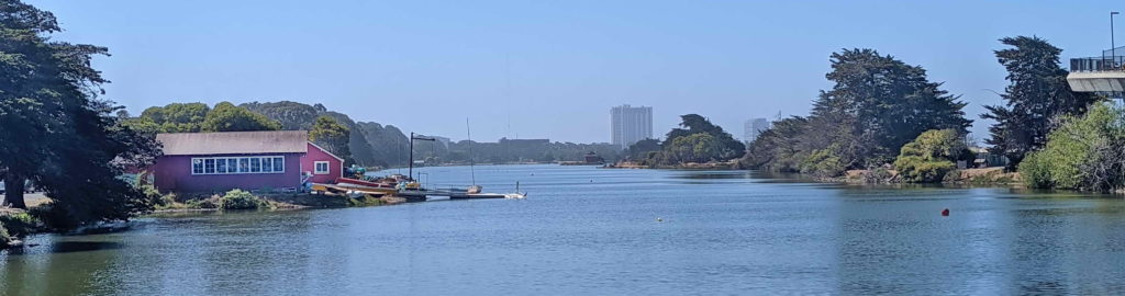
Above: The park opened in spring 1937, the year after the Bay Bridge that led to its creation. Although still largely bare, as these photos show, it was an immediate hit. The left photo, taken from the west shore, shows the beginnnings of the island, which has gone through several uses. The photo on the right shows the small-boat concession left of Bolivar Drive. Today, painted red, it is used by nonprofits. Right of Bolivar Drive hulks the derelict 1870s Standard Soap Factory, Berkeley’s first big industry. The site now houses the Berkeley Commons lab project.

The City of Berkeley’s 1936 as-built plan for the water system, above, shows that the park followed many but not all of its original concepts. It remains troubled by conditions that could be said to stem from its hasty start and lack of careful planning: not enough water circulation and exchange, pollution from mainland and highway, steady silting in, the noisy west side, the isolated south end. But Aquatic Park remains loved and defended by many, and a source of many and varied creative citizen efforts.